Extreme Flooding in York, PA, Harrisburg
Sep 7, 2011; 2:13 PM ET
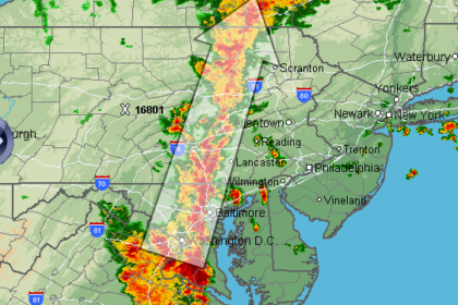
Extreme flooding is occurring today from Washington, D.C. northward through Ellicot City, MD, and York, Harrisburg and Williamsport, PA. The reason is that the same line of storms keeps moving northward and seems never-ending.
I just spent a while on the phone with my girlfriend in York, PA, trying to route her around flood waters. Photos appear below.
A lot of roads there are closed, and traffic tied up, including some major arteries as shown in the screen capture below from PennDOT (click for a live map). At 2:30 PM, they closed all exits between 18 and 21 on I-83 north of York.
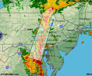
A radar estimate map (through this morning only!) is shown below. From actual rain gauges, here are the highlights: The USGS Hershey, PA Gauge reported 6.44″ today, 10.49″ since the weekend. Falmouth, PA: 5.79″ and 9.06″. Watsontown, PA got 7.42″; Bethlehem & Dover, PA have also reported 7″ total on CoCoRAHs. From NWS storm reports, Rockaway, NJ has totalled 8.43″ with 8.11 at Becket, MA and 7.5 at Elma, VA.

And that’s just the short-term flooding. Rivers take longer to rise, and I’m concerned about flooding in Harrisburg, Pennsylvania on Friday. The Susquehanna River is projected to rise from 5 feet yesterday (and 10 feet this morning) to 24.2 feet by the end of the week. Click below to see a live version of this graph:
At this level, it will only be 0.2 feet below the levels achieved during the 2004 flood, which also affected us here in State College. What might the river look like downtown? Check out these flooding photos from 2004, and consider the NWS’s “flood impacts” listed on the page above:
– The residential section of Front and Second Streets in Harrisburg flood at this level. Cameron Street in Harrisburg floods due to backwater from Paxton Creek.
– Evacuations are necessary in the Shipoke area of Harrisburg. The water level reaches the corner of Keller and Front Streets.
US 22/322 in the vicinity of the Dauphin Narrows is impacted by flood waters.
Homes on both banks are affected by high water. This is the approximate level of Routes 11 and 15…upstream of the Market Street Bridge.
A number of homes in West Fairview…Dauphin…and Harrisburg flood.
Basements of residences and businesses on both banks flood. The parking lot on City Island begins to take on water.
The recreation area of City Island is evacuated.


